Introduction to Baker Island North Baker Island North is a remote, uninhabited isle situated in the central Pacific Ocean, just a few kilometers north of the equator. As part of the United States Minor Outlying Islands, it lies roughly midway between Hawaii and Australia. Isolated from major human activity, this obscure landmass is rarely visited and holds a certain intrigue for scientists, adventurers, and radio amateurs alike. Despite its obscurity, the island’s unique geographical, ecological, and historical characteristics make it a point of interest for those fascinated by Earth’s most secluded corners. Geography and Location Baker Island North spans just over 2 square kilometers (0.77 square miles), making it a tiny dot amid the vast Pacific Ocean. Geographically, it is located at approximately 0°13′N latitude and 176°28′W longitude. The island is a low-lying coral atoll built upon a former volcanic seamount and fringed with a narrow reef that is often inaccessible due to high surf. It is roughly 3,100 km (1,900 miles) southwest of Honolulu, Hawaii, and about 1,800 km (1,100 miles) north of the equator. This positioning places it squarely in a zone characterized by strong sunlight, minimal precipitation, and high humidity, contributing to its arid scrubland environment. Volcanic Origin and Natural Features Like many central Pacific islands, Baker Island North is of volcanic origin. It once emerged as part of an underwater volcano, though erosion and coral growth over time have transformed it into its current flat, low-lying landscape. The island’s maximum elevation is a mere 8 meters (26 feet) above sea level, placing it at risk of sea-level rise due to climate change. Its terrain is composed of loose coral debris, and while few trees survive the arid conditions, native grasses and shrubs cling to existence. Lagoons or freshwater sources are absent, and the surrounding waters, although rich in marine life, present dangers associated with strong currents and sharp coral projections. The island is surrounded by a protective perimeter reef, which contributes to its ecological insulation while also increasing the difficulty of landing on its shores. Ecological Significance Despite its harsh conditions, Baker Island North possesses ecological importance, particularly as a haven for seabirds and other wildlife. The island is a designated U.S. National Wildlife Refuge and is part of the Pacific Remote Islands Marine National Monument. Its relative isolation and limited human disturbance have made it a critical breeding and nesting area for several bird species, including sooty terns, red-footed boobies, and frigatebirds. With no permanent freshwater and minimal rainfall—averaging just under 1,000 mm annually—the island supports only drought-tolerant vegetation, such as Portulaca, low-lying grasses, and a few hardy shrubs. Marine biodiversity around the island includes reef sharks, moray eels, and various tropical fish that thrive in the coral reef ecosystem. Occasionally, green sea turtles are spotted nesting on its sandy shores. Human Activity and Access Baker Island North has no known permanent inhabitants, nor has it ever supported a sustainable human population due to its arid climate and lack of resources such as freshwater. During the early 20th century, attempts were made to colonize the island through U.S. colonization projects like the American Equatorial Islands Colonization Project of the 1930s, which ultimately failed due to environmental challenges and World War II disruptions. A former landing strip once stretched across the island during a brief military occupation in World War II, but all that remains today are weatherworn ruins and remnants of radio towers. The U.S. Fish and Wildlife Service maintains the island as part of its remote field station network, although access is strictly controlled and limited to scientific and conservation missions. Travel to the island requires government permits, and the logistics of reaching its shores typically involve long sea voyages from neighboring Pacific territories or specialized aircraft under favorable weather conditions. Interesting Facts About Baker Island North Despite its small size and isolation, Baker Island North is surrounded by curious facts and trivia. For instance, it lies within both the Eastern Hemisphere longitudinally and the Western Hemisphere in terms of international interpretations of the 180th meridian, placing it within multiple time zones’ debate; however, it remains officially on UTC−12:00, one of the last places on Earth to experience a new day. The island also forms a separate DXCC entity in amateur (ham) radio terms, making it a coveted location for international radio amateurs. During rare DXpeditions approved by the U.S. government, operators set up temporary camps to broadcast from the island, allowing others to communicate from what effectively is one of the globe’s most uncontacted points. Interestingly, the island occasionally appeared by alternative names in nautical maps, including “New Nantucket” and “Howland’s Neighbor,” referring to the nearby Howland Island, another uninhabited U.S. territory. The pair is often mentioned together among WWII historians and Pacific island researchers. Legends and Lore of the Island In a location this remote, local legends are scant—but that does not mean it is without mystery. Old sailors used to refer to Baker Island North as the “Island of Shadows,” a reference to unexplainable atmospheric phenomena supposedly witnessed by naval navigators in the early 20th century. Glowing mists, sudden changes in compass bearings, and eerie sounds echoing from the reef gave rise to speculative tales that the island was haunted or “watched over” by ancient maritime spirits. One persistent legend among Pacific wayfarers is that Baker Island North was once part of a legendary “Ghost Archipelago”—a chain of islands that were said to disappear or move with the tides, appearing only under certain celestial alignments. Though clearly not rooted in science, such stories continue to provide romantic intrigue for explorers and writers alike. Conservation Efforts and Future Prospects Today, conservation is a central theme in the island’s continued stewardship. The U.S. Fish and Wildlife Service regularly monitors the island’s fragile habitat, aiming to preserve the wildlife and remove any invasive species inadvertently introduced by early visitors or washing ashore with ocean debris. Future prospects for Baker Island North are focused on climate impact monitoring, biodiversity preservation, and potential scientific study. Rising sea levels and increased storm intensity threaten the island’s reef and nesting sites, prompting international attention from climate researchers. In this way, Baker Island North serves as a living laboratory for understanding how isolated ecosystems respond to global environmental shifts. Conclusion Baker Island North may be one of the most desolate and uninhabited places on our planet, but through its volcanic history, ecological treasures, and elusive legends, it holds a richness that speaks to the power of our planet’s untamed frontiers. Though far from the bustling rhythms of civilization, it continues to captivate minds and challenge the limits of endurance and imagination. Whether through the lens of science, adventure, or folklore, the mysteries of Baker Island North remain as enduring as the Pacific tides that encircle it.
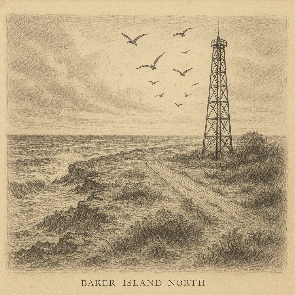
Baker Island North
Do you like my work? Buy Me A Coffee
Do you like my work? Buy Me A Coffee
-
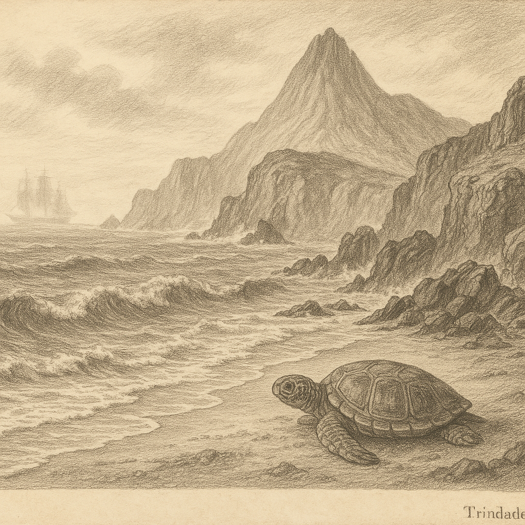
Trindade and Martim Vaz Island
Trindade and Martim Vaz Island: A Remote Outpost in the South Atlantic Trindade and Martim Vaz Archipelago, known in Portuguese as “Ilhas de Trindade e Martim Vaz,” is a remote group of volcanic islands located in the South Atlantic Ocean under Brazilian sovereignty. Situated approximately 1,200 kilometers off the eastern coast of Brazil near the…
-
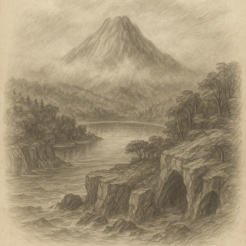
Hirakawa Island
Introducing Hirakawa Island Hirakawa Island is a remote and little-known landmass hidden in the Pacific Ocean, tucked away from the grasp of modern civilization. Shrouded in mist and mystery, it lies approximately 950 kilometers southeast of mainland Japan, nestled between the Philippine Sea and the vast Pacific. It is largely absent from commercial maps, yet…
-
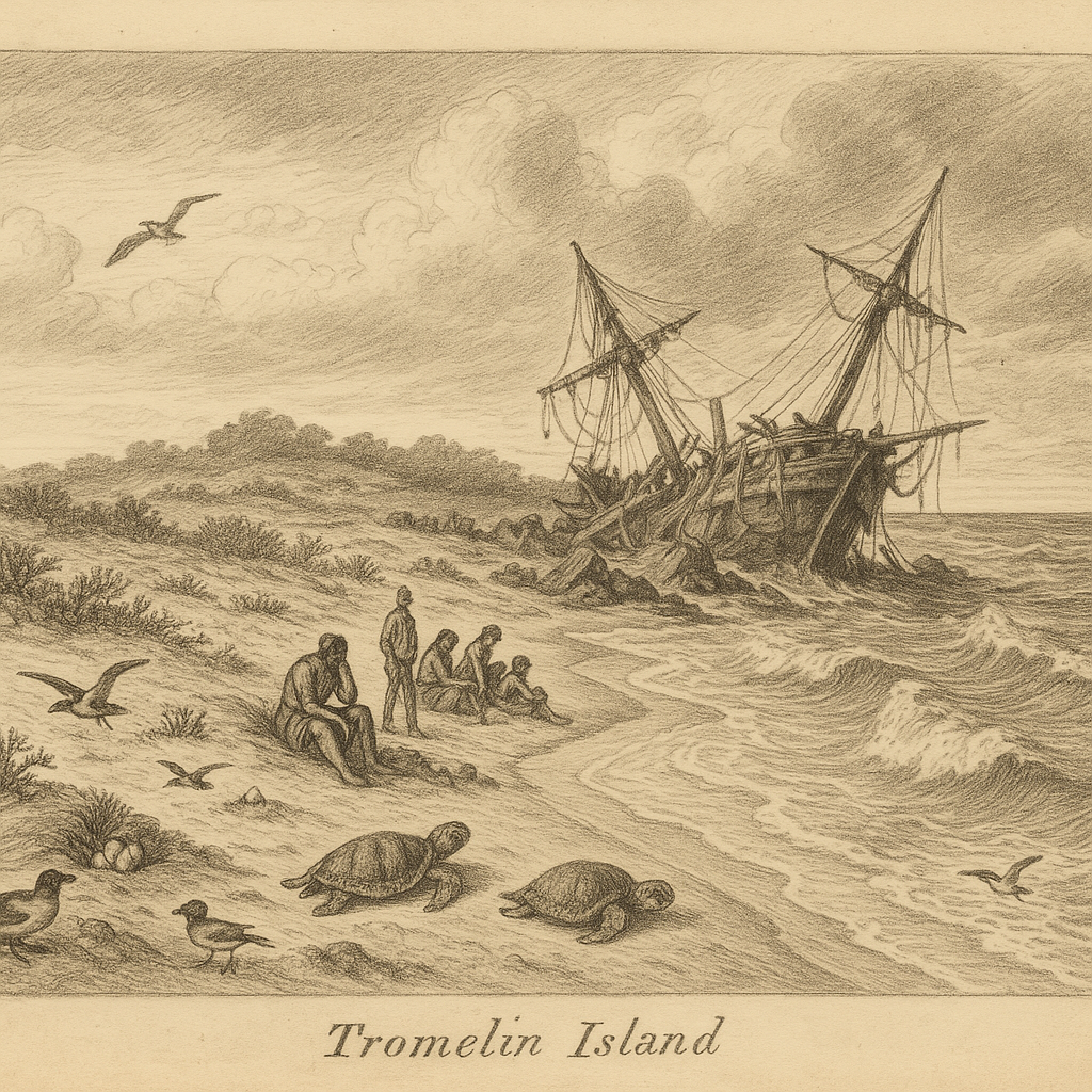
Tromelin
Introduction to Tromelin Island Tromelin Island is a small, flat island located in the Indian Ocean, east of Madagascar and north of Réunion. Covering only about 1 km², it is one of the most remote and isolated territories under French administration. Despite its diminutive size and barren appearance, Tromelin carries a fascinating history, intriguing legends,…
by
Tags: